A Map Walk for a Rainy Afternoon
A map walk for a rainy afternoon turns contours and symbols into a quiet route-reading exercise, revealing what a small area makes visible.
The common mistake in a map walk for a rainy afternoon is to begin by tracing the neatest line between two points. That skips the useful work: noticing what the map emphasizes, what it leaves ambiguous, and how those clues shape a route on paper. A small, carefully chosen area makes those distinctions easier to see.
Choose a patch with several kinds of clues
Use a printed topographic map, a paper street map, or a digital map that lets you inspect contours and symbols without immediately switching to turn-by-turn directions. Choose a compact patch that includes at least two kinds of terrain or land use: perhaps a wooded slope beside a neighborhood, or a small town edge where streets meet fields. The aim is variety, not a famous destination.
Settle on a map scale that keeps the whole patch legible. If the area is too broad, individual symbols blur into general patterns; if it is too tight, there may be no meaningful choice of route. A map’s scale bar helps you judge the area without relying on screen zoom alone.
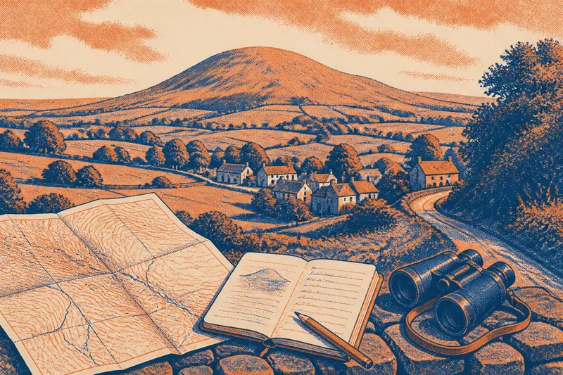
Keep a pencil, plain paper, and a ruler nearby. A transparent overlay is useful if you want to preserve the original map, but it is not essential. Avoid starting with a list of places to visit. For this exercise, the map itself supplies the starting point and destination.
Read contours before drawing a line
Look first at the contour lines, the marks that connect places of equal elevation. Their spacing offers a relative clue: closely spaced contours indicate a steeper slope than widely spaced ones. A contour pattern can also show a ridge, a hollow, or a rounded high point, though the exact shape may be easier to read alongside shaded relief if the map provides it.
Do not treat the contour lines as a miniature view of the ground. They simplify a surface, and their interval—the vertical change represented between successive lines—depends on the map. Check the legend or map margins for that interval. When the contours are faint or crowded, describe what you can confidently see rather than assigning a precise shape.
Next, note where the terrain seems to offer easier passage. A route that follows a gentler contour may avoid a steep climb, while a path cutting directly across closely spaced lines may cross a sharper slope. Those are clues about the map’s portrayal, not promises about current ground conditions.
Compare symbols with the terrain
Read the legend before interpreting marks as roads, paths, buildings, water, woodland, or boundaries. Symbols vary among map publishers and map types. A solid line, dashed line, or colored area can have a particular meaning on one map and a different one elsewhere.
Then compare the symbols with the contours. Does a mapped path seem to follow a valley or ridge? Do buildings cluster on flatter ground? Does a road cross a stream or pass through a narrow gap between hills? The point is not to invent a story for every mark, but to notice where the map’s different layers agree, and where they leave a question open.
Names can add another layer of attention without settling the interpretation. A label may distinguish a local feature, but it does not by itself explain its origin or confirm what a place looks like today. Use names as map evidence, not as a substitute for it.
A hypothetical walk from a town edge to a lookout
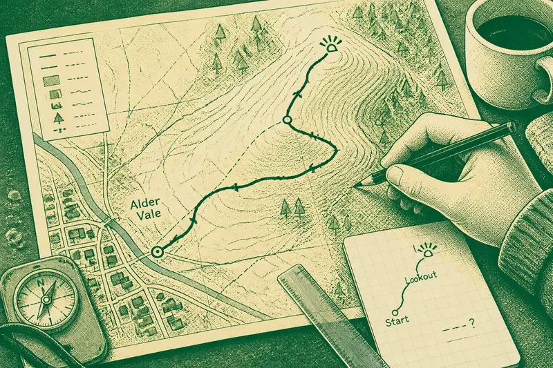
Imagine you have a printed map of an invented place called Alder Vale. Its small town sits beside a wooded rise, and a marked footpath runs from the edge of the streets toward a lookout symbol near the top. A stream crosses the lower part of the area, while contours bunch together on the rise’s eastern side.
Start by tracing the path with your eyes, not your pencil. It appears to head uphill toward the lookout, but the eastern slope is drawn with tighter contour spacing than the western side. A second mapped track curves around the west, where contours are more widely spaced. The map suggests a choice between a direct-looking climb and a longer line that appears less steep.
Now inspect the symbols and the legend. The marked footpath is distinct from the wider road through town, and the stream has a mapped crossing close to the settlement. The route around the western side does not appear to cross the stream again. You cannot infer from those symbols alone whether the path surface is firm, open, or passable on a particular day.
For a paper route, place a starting point at the town edge and a destination at the lookout symbol. Draw the route through the mapped footpath, then bend it toward the west side of the rise before turning toward the destination. Keep the line on mapped paths where possible, and use the contours to avoid drawing a sudden, unexplained cut across the steepest-looking slope.
The result is not a claim that this is the best real-world way to reach a lookout. It is a route built from visible map evidence: a mapped start, a destination, a path, a stream crossing, and a difference in slope. If the map does not show a connecting path where your pencil wants to go, leave a gap or mark the uncertainty rather than quietly making one up.
Sketch only what the map can support
Draw the route on plain paper or an overlay, preserving the map’s scale as closely as the format allows. Mark the starting point and destination, then add only a few landmarks that help explain the line: a path junction, a stream crossing, or a noticeable bend in the contours. A north arrow can orient the sketch, while a brief note can record why you chose the western slope.
Use a dashed segment for a connection that is uncertain or not clearly mapped. Add a question mark beside a symbol whose meaning you cannot confirm, then check the legend rather than guessing. This keeps the sketch honest: it separates what the map shows from the decisions you made while interpreting it.
Do not try to turn the exercise into a complete field-navigation plan. A map can be old, simplified, or incomplete, and a paper route does not establish present access or conditions. If you intend to use a route outdoors, consult current local information and follow posted signs and access rules.
What questions help make the map walk useful?
How small should the area be?
Choose an area small enough that you can inspect every contour and route symbol without losing the larger shape of the landscape. A town edge, a park boundary, or a short stretch between a stream and a hill can provide enough detail for a thoughtful comparison.
Can I use a phone map instead of paper?
Yes, if the map shows a readable legend, contours, and the symbols you want to compare. A screen can make it easy to move between scales, but keep the view steady while you sketch so that changing zoom does not quietly change your sense of distance.
What if the map has no contour lines?
Use the visible relief shading, spot-height marks, or terrain labels if the map includes them, and state the limits of those clues. If none appear, you can still compare routes, water, buildings, and land-cover symbols, but do not infer slope from missing contour information.
Should the sketched route follow the shortest path?
Not necessarily. The shortest drawn line may ignore steep slopes, streams, or gaps in mapped paths, while a curved route can better reflect what the map makes visible. For this indoor exercise, the useful choice is the one you can explain from the map’s clues.
Keep the exercise quiet and specific
When the sketch is finished, write one sentence beside it that names the deciding clue: perhaps the wider contour spacing, a mapped crossing, or the way a footpath bends around a slope. Then note one unresolved question, such as whether a connection is actually marked or what a symbol means. These two notes preserve both the reasoning and its limits.
What is not worth the effort is tracing every building, measuring every bend, or decorating the page until the route looks authoritative. Those additions can make a simple map reading harder to inspect. A few precise marks are enough to show how the evidence guided your choice.
A map walk for a rainy afternoon works best as a small act of attention: one patch, a handful of visible clues, and a route whose shape has a reason. The useful result is not a perfect itinerary but a clearer sense of how contours, symbols, and omissions influence the lines we draw.